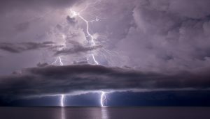
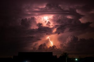
 In New Zealand thunderstorms and lightning are some of the most exciting and dramatic weather events we see. It is estimated that about 2000 thunderstorms are happening across the world at any one time. Thunderstorms have their importance in the world, bringing regions much needed rainfall, however they can also be destructive forces and a risk to life. In addition to lightning, thunderstorms can also bring heavy rain, hail, tornadoes, and waterspouts.
Most thunderstorms occur from massively tall cumulonimbus clouds. The sun warms moist air near the earth’s surface and makes it rise. As this air moves upwards it cools and can condense to form cumulus clouds. The small, white fluffy cumulus clouds can group together and form one larger cumulonimbus cloud if there is enough rising warm air. If tall enough to reach the cooler air of the stratosphere, strong winds may widen the top of the cumulonimbus cloud. This may have the appearance of a top-heavy, flattened, anvil shape and is a good indicator that a thunderstorm is on its way.
The way thunderstorms form mean they are more common in the afternoons of tropical regions where there is more moist, warm air and more heat to make it rise. Most parts of the world have thunderstorms, especially mountainous areas, which help form cumulonimbus clouds with increased uplift of air. Only hot, dry deserts and extremely cold polar regions rarely see thunderstorms.
What makes thunder?
Thunder is the rumbling or crack of sound that can usually be heard from the sky during a storm. Thunder is caused because lightning heats up the air, to about 30 000ºC, causing it to expand quickly. The rumbling occurs as the sound passes through atmospheric layers at different temperatures.
How far away is a thunderstorm?
An estimation of how far away a storm is can be made by counting the number of seconds between a lightning flash and the start of thunder. If you divide this number by five, the answer is how many miles away the storm is from you.
Lightning
Lightning is thought to be due to the formation of ice crystals in the top layers of the cumulonimbus cloud as it reaches a cooler part of the atmosphere called the stratosphere. As these crystals bump into each other a tiny bit of electrical energy (charge) may be created within a larger, storm-wide, electrical field. It works a bit like static electricity on your hair from a jumper, or from a desk chair wheeled across a carpet.

Light, positive charged ice and water gathers at the top of the cloud and the heavier negative particles gather at the base. The ground below is also positively charged. The difference in electrical charges can become so great that energy is released as lightning. A typical discharge is usually about 1.5 million volts and most of this is changed into heat energy. Although these high temperatures only last a millionth of a second it is enough to vaporize the fluid of a tree and cause it to explode.
Although lightning appears to move from clouds to the ground, the flash we see is actually returning to the storm clouds. Lightning can be sheet lightning occurring within the cloud or fork lightning between clouds. Lightning sensors have been used to track lightning since the 1980s. Satellites have been used to collect long-term data on all lighting since the 1990s, and the global average has been calculated at 30 – 40 flashes per second.
90% of lightning never reaches the ground, but when it does it can strike twice. The Empire State Building in New York has been hit 48 times in one day. Single trees on high, exposed ground are likely to be hit by lightning. You are safe inside a car as lightning is carried to the ground through the metal body of the car instead of through the person inside.